Introduction and summary
An agency little known to many Americans,1 the U.S. Bureau of Land Management (BLM), oversees 245 million acres of public lands,2 more than any other U.S. land manager.3 These public lands offer spectacular vistas, irreplaceable cultural resources, critical wildlife habitat, sources of clean water, world-class recreational opportunities, and the potential to combat climate change.
The overwhelming majority of these lands—more than 86 percent—lack durable protections from oil and gas leasing, mining, and other extractive industries. In fact, oil and gas drilling remains the preferred use of the BLM’s public lands, and existing regulations give the oil and gas industry excessive power in determining use outcomes.4 Despite a mandate to manage these public lands for the use and enjoyment of present and future generations, the BLM has never established comprehensive regulations for conserving its natural wonders.
A proposed Public Lands Rule released by the Biden administration on March 30, 2023—open for public comment through June 20—would begin to remedy these gaps and balance how the BLM oversees these lands. Among other things, the proposal would establish management requirements that put conservation on par with resource extraction and would direct the BLM to conserve intact landscapes, manage for ecosystem resilience, and utilize conservation tools—including designating lands as “areas of critical environmental concern” (ACECs)—to protect its natural, cultural, and scenic wonders, and restore priority lands and waters.5
To put in perspective what is at stake, this report looks at seven areas managed by the BLM. These areas are a small sampling of the nation’s treasured lands and waters lacking meaningful conservation protections. The examples illustrate the need for the Biden administration to finalize a strong Public Lands Rule and act on community-led conservation proposals to steward America’s public lands for future generations.
What’s at stake
Intact BLM lands serve as vital habitat and migration corridors for wildlife; preserve cultural sites and a history stretching back millennia; offer outdoor recreation and related economic opportunities; and buffer the nation’s natural resources and communities against accelerating climate change. Yet with just 35 million acres of the 245 million acres managed explicitly for the conservation of their natural and cultural resources6 and the vast majority available for leasing, drilling, and mining, BLM lands are also America’s most vulnerable public lands. On the flip side, these lands represent one of President Joe Biden’s most significant conservation opportunities.
Wildlife habitat, ecosystem resilience, and climate change
BLM lands provide habitat for more than 3,000 wildlife species;7 more than 300 threatened or endangered wildlife, fish, and plant species;8 and more than 1,800 rare plant species, including more than 300 rare plant species found solely or mostly on BLM lands.9 Survival of vulnerable species such as the greater sage-grouse and big game such as elk, pronghorn, mule deer, and bighorn sheep depends on healthy, unfragmented landscapes managed by the BLM. Notably, the ecological value of BLM lands is not limited to existing protected areas. Regional-scale analysis has found a substantial opportunity to conserve unprotected BLM lands with more biodiversity and climate resilience value than already protected BLM lands and more rare species, on average, than national park lands.10
Unprotected BLM lands also serve as a natural buffer against the effects of climate change. Many of these lands provide the connective tissue between protected areas, serving as migration corridors for wildlife today and improving the chances for species to adapt as their natural habitat ranges are disrupted by climate change. Multiple analyses have shown that unprotected BLM lands contribute more to connectivity between protected areas than other federal land management agencies, demonstrating the importance of keeping these lands intact.11 Additionally, new BLM land protections would help secure essential natural carbon stores. One analysis found that preventing industrial development on about 10 percent of currently unprotected BLM lands with high conservation value could secure an estimated 3 billion tons of natural carbon stock,12 equivalent to the carbon emitted annually by nearly 3,000 coal-fired power plants.13
Outdoor recreation opportunities and economic benefits
Both protected and unprotected BLM lands offer a wide range of outdoor recreation opportunities for neighboring communities and visitors alike, including hiking, mountain biking, hunting, fishing, climbing, boating, camping, and more. As better-known parks become overcrowded, BLM-managed lands have and will become increasingly important to meet this growing public demand. When the coronavirus pandemic created spikes in demand that overcrowded places such as Arches National Park near Moab, Utah, visitors reportedly turned to nearby BLM lands to recreate.14
Outdoor recreation on BLM lands also contributes substantially to local economies, including for many rural communities. Although data collection is limited, the BLM recorded more than 80 million visits, contributing an estimated $11.4 billion to the national economy in fiscal year 2021.15 Another study estimated that wildlife-related recreation alone on these lands generated 26,500 jobs, more than $1 billion in wages, and more than $421 million in tax revenue in 2016.16 Finally, the BLM’s data show that outdoor recreation is on a growth trajectory, consistent with trends observed across all public lands in the past decade, even before pandemic-related spikes.17
Sacred places, cultural resources, and historic and prehistoric sites
According to the U.S. Department of the Interior, the BLM manages the “largest, most diverse, and most scientifically important” collection of cultural and paleontological resources on public lands, which hold the stories of thousands of years of human inhabitants and prehistoric life.18 With an ongoing inventory, the BLM has already recorded more than 426,000 different cultural sites on less than 12 percent of its lands.19 Additionally, in 2010 alone, a record-setting seven new species of dinosaur were discovered on BLM lands in Utah.20
Strong BLM conservation regulations and wise management decisions could help protect known and undiscovered cultural and historical resources from destruction by mineral extraction and other development. Unfortunately, these are not abstract threats. The Trump administration offered large swaths of archaeologically dense lands in southeast Utah for lease to the oil and gas industry in 2018 and 2019, to the alarm of Tribes, local communities, historical preservation experts, and even the National Park Service.21 In the case of the Hovenweep National Monument area, as little as 2 percent of leased lands in the cultural landscape surrounding the monument were surveyed for cultural and archaeological sites before they were leased for drilling.22
Significantly, new BLM regulations and related policies would also empower Tribes to lead and inform the management of sacred and culturally important lands and waters. Following new direction from President Biden and U.S. Secretary of the Interior Deb Haaland, the proposed rule acknowledges the importance of co-stewardship agreements and would enhance requirements for the BLM to consult with Tribes meaningfully and to consider Indigenous knowledge in making management decisions.
Tribal co-stewardship of lands and waters
The BLM’s proposed conservation regulations also follow new direction from President Biden and Cabinet leaders, including Secretary Haaland, to strengthen the role of Tribal communities in federal lands management. In just the first year after President Biden launched this “Tribal Homelands Initiative” in November 2021, the Department of the Interior completed 13 co-stewardship agreements with 18 Tribes, Alaska Native Corporations, and Tribal consortia.23 Through co-stewardship agreements, Tribes are given an enhanced role in managing federal lands, which were at one point virtually all Indigenous territories stewarded by Indigenous peoples. These agreements can take a range of forms, from contracts for the direct operation and maintenance of federal lands and waters to reintroduction and management of fish and wildlife populations.24
Seven unprotected places highlighting what’s at stake
The places highlighted below provide a concrete glimpse of what is at stake across unprotected BLM lands and waters. As these examples illustrate, too many treasured places lack meaningful protections under the BLM’s management scheme, which overwhelmingly favors extractive industry and short-term profits over the well-being of future generations.
A Public Lands Rule should ensure that the most critical lands—such as the ones described here—are protected for future generations, that Tribally and community-led conservation proposals receive full consideration, and that landscape health is achieved across all public lands. Specifically, the proposed rule directs the BLM to identify and conserve “intact landscapes” of high conservation value; requires that management decisions avoid impairing ecosystem resilience; emphasizes opportunities for Tribal co-stewardship; and requires Tribal consultation and consideration of Indigenous knowledge.25 In addition, the proposed rule would strengthen requirements for the BLM to consider and establish areas of critical environmental concern—areas that are specially managed to protect natural, cultural, and scenic resources—and would make it more difficult for the agency to arbitrarily eliminate ACEC protections once established. This strengthened ACEC tool could help secure protections for lands within several of the regions highlighted below.
Alaska: The Bering Sea-Western Interior
In western Alaska, the BLM manages 13.5 million acres in its Bering Sea-Western Interior planning area, much of it sandwiched between the Yukon Delta, Innoko, Koyukuk, and Selawik national wildlife refuges. Home to more than 65 federally recognized Tribes, this remote area contains abundant fish, wildlife, and other natural resources necessary for subsistence and cultural practices by Alaska Native communities who have stewarded the land for thousands of years.26 The area encompasses most of three major watersheds, including the Yukon River, which the BLM recognizes as an internationally significant fisheries resource.27
![]()
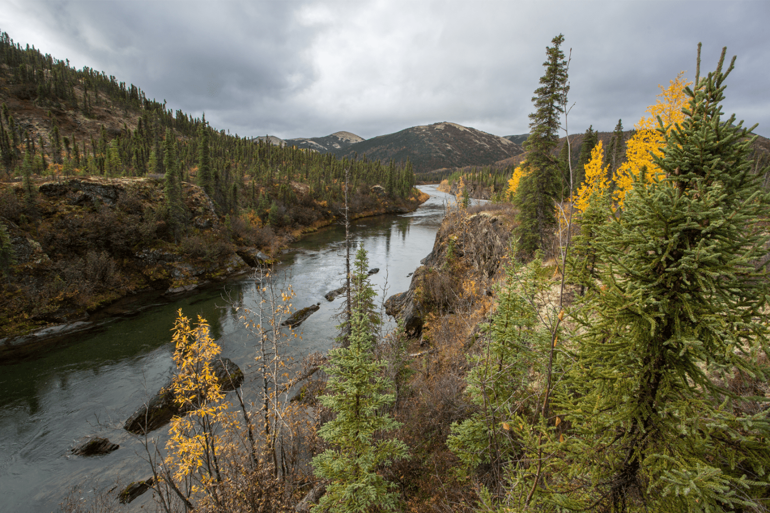
Bering Sea-Western Interior area, Alaska. Photo credit: David Shaw
When the BLM was updating the management plan for this region several years ago, Tribes nominated 4.5 million acres of watersheds for conservation as ACECs.28 For example, the Nulato Tribal Council called for the creation of a Nulato River ACEC to protect the community’s clean water source; major spawning areas for salmon, shellfish, grayling, and trout; calving grounds for moose and caribou; and other critical resources that sustain the Nulato community. The BLM determined in 2018 that the proposal met the agency’s own criteria for ACECs due to its highly productive fish habitat.29
Before 2021, the BLM already managed 11 unique areas in this region as ACECs. These included the Gisasa River ACEC, which the U.S. Fish and Wildlife Service determined to host important spawning habitat for chinook and chum salmon, support essential subsistence uses for many rural communities, and be particularly sensitive to mining impacts.30 Similarly, the existing Anvik River ACEC protected a watershed that the BLM itself described as the largest wild stock producer of summer chum salmon in the region “and possibly the world,” noting that commercial and subsistence fisheries depended on this resource.31
Just as President Donald Trump left office in January 2021, the BLM issued a final plan that opened 99 percent of the Bering Sea-Western Interior area to future mining and drilling and stripping away existing protections for large swaths of sensitive lands. Ignoring Tribes and many of their previous conclusions, the BLM rejected all conservation proposals and eliminated all previously established ACECs, covering 1.8 million acres.32 The Bering Sea Interior Tribal Commission, initially formed in 2019 and now including 37 member Tribes, has called on the Biden administration to revisit the reckless management plan and reconsider Tribal nominations to protect important places and watersheds.33 Had a strong Public Lands Rule been in place at the time, including proposed provisions preventing the BLM from arbitrarily removing protections for existing ACECs, such egregious and extensive rollbacks may not have occurred. Moving forward, more robust ACEC tools and a focus on Indigenous knowledge in the rule could help protect places Tribes have nominated for ACEC designation.
The lands and waters we depend on for traditional harvest are necessary for practicing what the federal government refers to as our ‘subsistence priority.’ We call it life.
– Koyukuk Tribal Council commenting on the Gisasa River ACEC before it was eliminated by the BLM
The BLM’s mandate is to balance uses on the public lands it manages, and it has a special trust responsibility to the tribes that call this region home. Opening 99 percent of the land to exploitation not only fails to strike that balance—it openly mocks it.
– Leaders of the Bering Sea-Interior Tribal Commission
California: English Ridge
In northern California’s Mendocino County, English Ridge is an incredible 6,000-acre landscape, interspersed with meadows and covered in ancient forests of Douglas fir, pines, and among the greatest diversity of native oaks in the state.34 With ridges rising steeply from the protected Eel River, the BLM lands include extensive streamside habitat along Fish Creek and Indian Creek, which the agency specifically identified as eligible for “wild and scenic” status. The streams provide spawning habitat for threatened salmon and steelhead trout that travel from the Pacific Ocean,35 and the rich habitat along these creeks and ridges is home to the bald eagle, fisher, marten, badger, endemic plant species, and much more.36 The old-growth forests within English Ridge also shelter the threatened northern spotted owl.37 And the Eel River, which passes through this area, is a popular whitewater rafting and kayaking destination.38
![]()
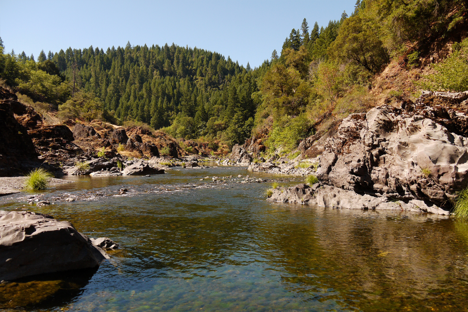
The Eel River, English Ridge proposed wilderness area, California. Photo credit: Jim Rose
In 2011, the Department of the Interior identified English Ridge as appropriate for “immediate congressional action” to designate the area as protected wilderness,39 and the BLM identified the lands for their “wilderness characteristics” in a 2016 inventory. For decades, the neighboring community has sought additional protection for this area, and a wilderness bill that would protect it, led by Rep. Jared Huffman (D-CA) and Sen. Alex Padilla (D-CA), awaits action in Congress.40
Despite repeated calls to protect this area, English Ridge needs more substantive protection today. A recently launched process to update the BLM’s management plan for northern California41 will allow the agency an opportunity to change that, and local advocates are calling on the BLM to formally manage the area to conserve its wilderness values and to help improve public access.42 The Public Lands Rule should help ensure that the BLM’s planning processes lead to meaningful protections for places such as English Ridge by providing the BLM with clear direction and tools for conserving its most ecologically valuable lands and waters.
Wyoming: Boars Tusk and Indian Gap Trail
More than 30 tribes—including the Shoshone, Ute, Bannock, Arapaho, Cheyenne, Lakota, and Crow43—maintain ancestral ties to Wyoming’s Red Desert, an impressive expanse of high-altitude desert south of the Wind River Reservation ceded by the Shoshone-Bannock and Eastern Shoshone in the Fort Bridger Treaty of 1863.44 Since 2003, the Eastern Shoshone and Northern Arapaho Tribes have sought protections for Boars Tusk and Indian Gap Trail,45 two sites of cultural and historical significance in the Red Desert.
![]()
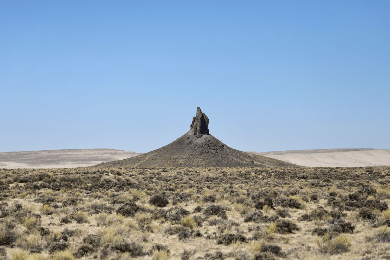
Boars Tusk, Wyoming. Photo credit: Meghan Riley
Boars Tusk, an area encompassing 4,524 acres,46 is home to a towering sandstone rock formation more than 400 feet tall that holds spiritual significance for the Shoshone and Arapaho Tribes. It is known as “the Parents,” or “Neniiheii” to the Arapaho Tribe, because the rock formations resemble two people with blankets around them.47 Formed millions of years ago, Boars Tusk continues to be visited every year by Tribes and non-Indigenous people alike.48 This area not only plays a role in cultural tradition, including in many creation stories, but it is also ecologically significant and provides critical habitat for vulnerable sage-grouse,49 a keystone species for sagebrush habitat.
The Indian Gap Trail was a trade route stretching from Wyoming to California, used by Indigenous peoples for thousands of years.50 The trail covers miles of rugged terrain and contains numerous cultural sites, including petroglyphs and rock art. For the Eastern Shoshone and Northern Arapaho Tribes, the trail holds substantial historical and spiritual significance, as a reminder of their ancestors’ journeys and a symbol of their cultural identity. This former buffalo trail was critical for food and medicine gathering, trading, and inter-Tribal meetings. The area also overlaps with mule deer migration corridors51 and winter ranges for mule deer52 and elk.53
Unfortunately, Boars Tusk and the Indian Gap Trail areas have experienced destructive recreational activities and vandalism, and they face additional threats from oil and gas development and natural deterioration. Both have recently been nominated for protection as ACECs by the Indigenous Land Alliance of Wyoming, which directly represents Tribes, with additional support from local groups and partners. The ACEC proposals include requests for co-stewardship and a collaborative management structure to engage Tribes in preserving cultural and natural resources. A process was launched in 2011 to update the area’s management plan, which dates back to 1997. That process has stalled, but the BLM recently recommitted to finishing the plan update.54 The Public Lands Rule’s stronger direction on ACECs and emphasis on ACECs as opportunities for Tribal co-stewardship should bring additional focus to areas that warrant protection such as Boars Tusk and Indian Gap Trail.
New Mexico: Otero Mesa
Otero Mesa, which covers 1.2 million acres of the Chihuahuan Desert in southern New Mexico, is home to rare and sensitive grasslands considered one of North America’s most endangered ecosystems.55 After the BLM opened 95 percent of this region to oil and gas drilling in 2004, then-Gov. Bill Richardson (D), ranchers, sportsmen, conservation groups, and other New Mexicans rallied to oppose the drilling plan and subsequent attempts to lease hundreds of thousands of acres.56 They ultimately succeeded in court, sending the BLM back to the drawing board.57 Though Otero Mesa ranks in the 98th percentile for ecological connectivity across all BLM lands across the West, it lacks protection from destructive development.58 The Coalition for Otero Mesa submitted a formal proposal in 2008 for the BLM to protect approximately 584,000 acres of Otero Mesa’s most important grasslands. Still, this request has sat unfulfilled, and these lands remain under threat.59
![]()
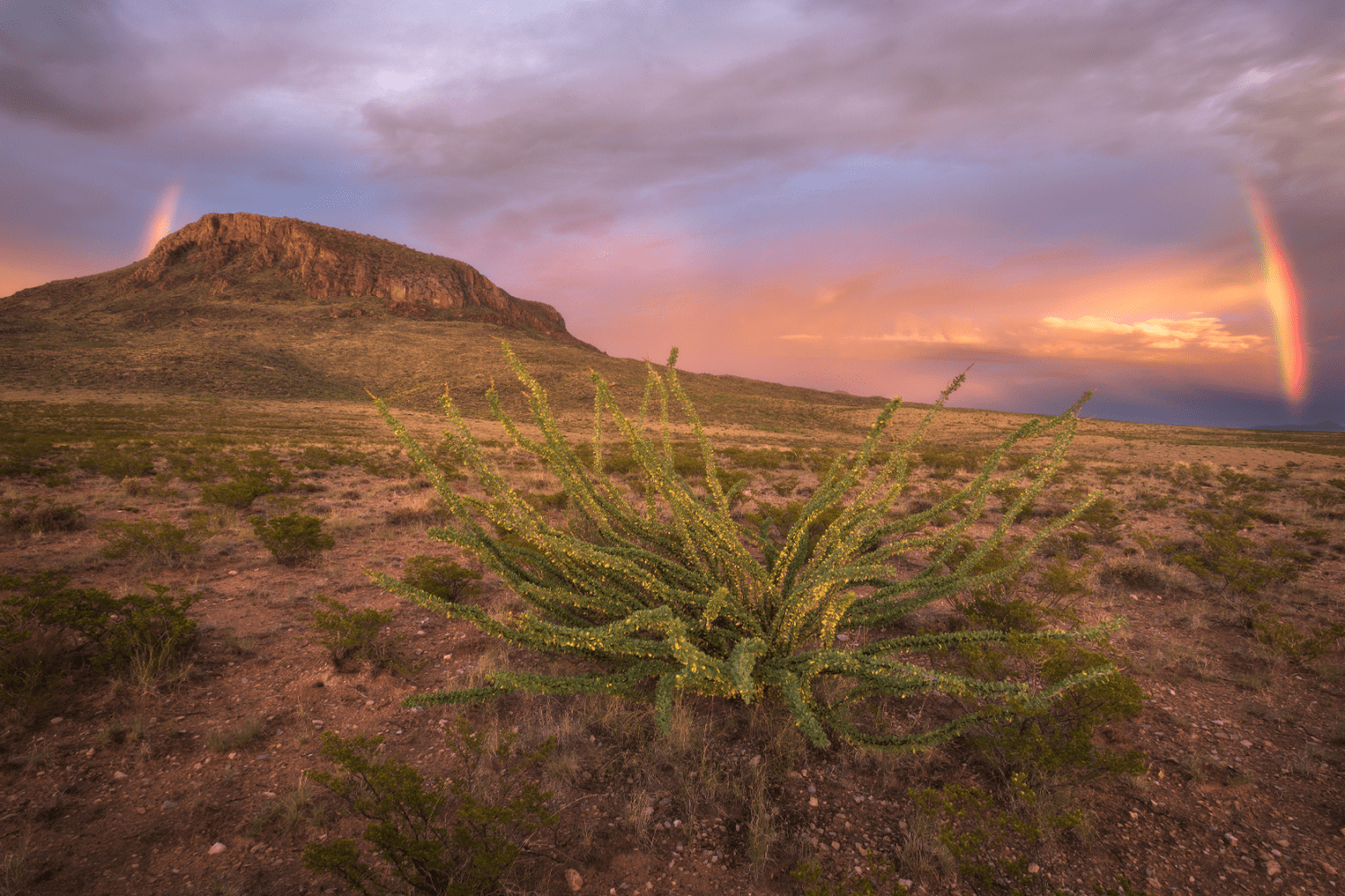
Otera Mesa, New Mexico. Photo credit: Mason Cummings, The Wilderness Society
In a region that has lost almost all of its natural grasslands due to human activity, Otero Mesa is an ecological gem, encompassing one of the most extensive remaining tracts of black grama grassland in the Chihuahuan Desert.60 Otero Mesa’s grasslands are home to one of the few native pronghorn herds in New Mexico and provide vital habitat for a variety of grassland birds, black-tailed prairie dogs—a keystone species—and other unique and imperiled species, while offering hope of restoring desert bighorn sheep and other animals to their historic ranges.61 Otero Mesa has even been identified as an “important bird area” by the National Audubon Society.62
The Chihuahuan Desert is also one of the most biodiverse desert ecosystems in the world63 and is known for having the most incredible diversity of cactus species in North America.64 Significantly, Otero Mesa sits atop a large aquifer that could serve as a source of freshwater for local communities and wildlife well into the future.65
In addition to its ecological values, Otero Mesa is culturally and historically significant. People have been drawn to this region for thousands of years, and it houses a remarkable diversity of cultural sites, including world-class petroglyphs and pictographs, rock shelters, cave-caching sites, stone tool quarries, and more.66 Otero Mesa is home to some of the most sacred places for the Mescalero Apache, is significant for the Tigua Tribe of Ysleta del Sur Pueblo, and is known to encompass the battle sites and trails of the Buffalo Soldiers and Texas Rangers.67
Despite its ecological and cultural significance, Otero Mesa remains highly vulnerable. In addition to the threat from oil and gas development, Otero Mesa is also threatened by poor grasslands management, drought, wildlife disease, habitat fragmentation,68 and even proposals to store nuclear waste.69 However, an ongoing BLM management plan update initiated in 201770 presents an opportunity to provide long-awaited relief to this threatened place. The Public Lands Rule’s focus on ecosystem resilience, intactness, and landscape health can help protect Otero Mesa through this ongoing management planning process.
Colorado: Uncompahgre Area
On Colorado’s western slope, south of Grand Junction, the BLM manages nearly 1 million acres of public lands around the Uncompahgre Plateau, including spectacular high-desert mesas and canyons along the Dolores River to the west, ecologically rich slopes on the plateau’s eastern edge, and lands surrounding the agricultural communities of the North Fork Valley. For decades, local communities have worked to protect public lands in this area. Yet a history of unbalanced decisions by the BLM illustrates why new regulations are needed to guide the management of BLM lands.
![]()
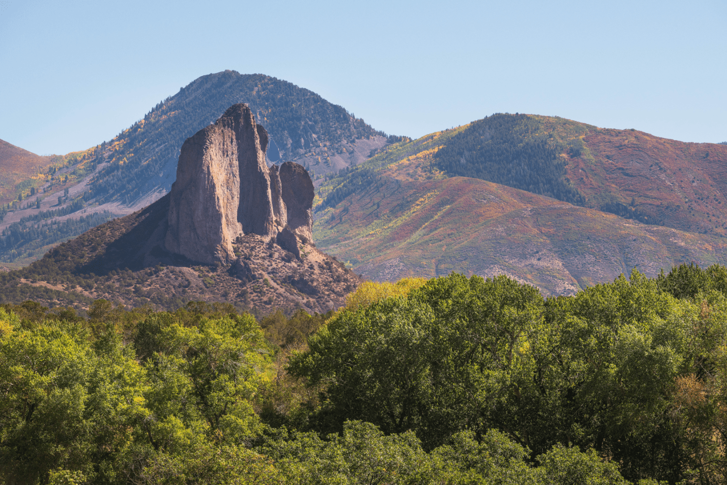
The North Folk Valley, Colorado. Photo credit: Mason Cummings, The Wilderness Society
Ten years after launching a process to update the area’s management blueprint, the BLM finalized a plan in 2020 that opened 95 percent of available BLM lands to oil and gas leasing while ignoring most proposed conservation protections. Despite finding that more than 185,000 additional acres met the agency’s requirements for designation,71 the BLM’s final plan eventually increased total ACEC coverage by just 190 acres and walked back plans to offer any meaningful protections for lands identified for their wilderness character.72 Among the areas left unprotected were the Roubideau-Potter-Monitor area (20,430 acres) and the Lower Uncompahgre Plateau Cultural area (31,810 acres). In its evaluation, the BLM noted the high biodiversity values of the steep canyons, riparian forests, and streams of the Roubideau-Potter-Monitor area, which provide habitat for peregrine falcons, desert bighorn sheep, and other sensitive species, as well as the “spectacular views” and abundant archaeological and historic sites.73 Likewise, the BLM had found the neighboring Lower Uncompahgre Plateau Cultural area to contain “nationally significant” archaeological sites and important cultural and sacred sites for Ute Tribes, yet it too was left unprotected in the final plan.74
The BLM also rejected a pragmatic, grassroots-driven alternative to limit and manage the effects of oil and gas development in the North Fork Valley. This alternative, developed by agricultural, tourism, realty, business, and conservation organizations, would have preserved the rural character, land health, and water quality essential for the region’s successful farms, wineries, and agritourism, as well as hunting, fishing, and other recreation opportunities valued by the community.75 Further west, the majestic canyons of the Dolores River were also left unprotected by the BLM’s management plan despite the threats of renewed uranium mining and other harmful activities.76
Fortunately, the BLM will soon have a chance to remedy its errors. Conservation organizations, and the state of Colorado separately,77 challenged the BLM’s final plan as unlawful, and the agency agreed to reconsider lands available for oil and gas leasing and the designation and management of lands for conservation.78 The Public Lands Rule should help ensure that a new plan includes adequate protections for the valuable landscapes of the Uncompahgre Plateau.
Nevada: Mule deer corridors
In and around western Elko County, Nevada, critical wildlife corridors northeast of Battle Mountain sustain one of Nevada’s largest mule deer herds, known as the “Area 6 herd.”79 Hunting generated an estimated $379 million in expenditures in Nevada in 2020, with more than $50 million directly attributed to mule deer hunting.80 Statewide, Elko County realized the highest total economic contribution from hunting.81 In this area of the Great Basin, characterized by high mountain ranges and broad valleys, subpopulations of mule deer migrate 30 miles to 80 miles between highly productive summer habitat at upper elevations down to a lower elevation transition and winter range, much of which is managed by the BLM.
![]()
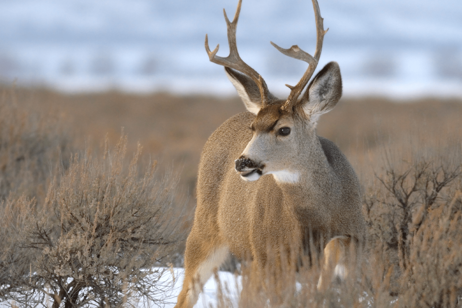
A mule deer. Source: Getty
Although abundant and diverse forage in the mule deer’s summer habitat could support a much larger herd, the winter range has been substantially degraded and constricted over time. Historically, this winter range was sagebrush steppe filled with native shrubs, but repeated wildfires, exacerbated by drought, have replaced much of the traditional vegetation with invasive cheatgrass, requiring substantial and expensive restoration efforts. In fact, biologists found that recent wildfires have affected 73 percent of the winter range for these deer.82 Poorly managed grazing has also degraded habitat conditions, and extensive fencing impedes herd movement. At the same time, existing mines and highways narrowly restrict migratory corridors down to just 600 meters wide in at least one case.83 The dramatic imbalance between productive summer and degraded winter habitat has required sustained mule deer population management by wildlife agencies to prevent catastrophic die-offs.84
Further habitat loss, ecosystem degradation, and restriction of these critical wildlife corridors will imperil one of Nevada’s incredible natural and economic assets. In addition to mule deer, this area supports pronghorn, elk, and bighorn sheep and is critical for bolstering declining populations of sage grouse.85 Yet not only do these migratory corridors lack specific conservation status from the BLM, but the area’s management blueprint has not been updated in almost 40 years. Action by the BLM to revise its outdated plan, informed by the new Public Lands Rule, could make the difference for this unique landscape, enabling the agency to prioritize migration corridor conservation and climate-informed restoration in partnership with the state of Nevada, the U.S. Forest Service, and local hunting, fishing, and conservation groups.
Oregon: Greater Hart-Sheldon
The Greater Hart-Sheldon landscape extends across the northern Great Basin in southeastern Oregon and northern Nevada and offers some of the last best sagebrush habitat remaining in the West. Habitat loss and fragmentation from fossil fuel development, mining, invasive species, and wildfire have degraded this landscape and disrupted connectivity, rendering this “Sagebrush Sea” one of the most threatened ecosystems today.86,87 Historically covering more than 296 million acres,88,89 only half remains.90,91,92 The loss of sagebrush habitats has corresponded with an increase in imperiled plants and animals: there are more than 350 species of concern in the Sagebrush Sea.93,94 Vibrant, connected, and resilient, the Greater Hart-Sheldon landscape offers one of the best opportunities remaining to conserve sagebrush habitat and the diversity of flora and fauna that depend on this landscape.95
![]()
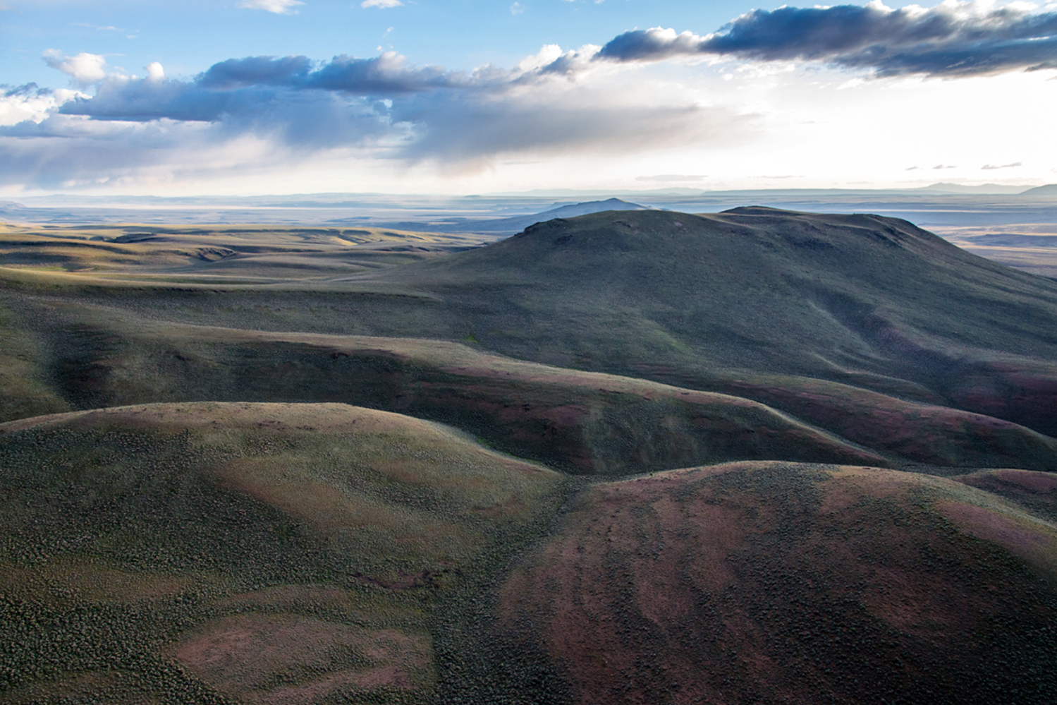
The Greater Hart-Sheldon area, Oregon. Photo credit: Jim Davis
The Greater Hart-Sheldon is anchored by two namesake national wildlife refuges, Hart Mountain National Antelope Refuge in Oregon and Sheldon National Wildlife Refuge in Nevada. President Franklin D. Roosevelt established Hart Mountain and Sheldon as a single national wildlife refuge, but his expansive conservation vision was later diminished into two smaller wildlife refuges.96 The BLM manages this vitally important 400,000-acre expanse between the two refuges. This “Land Between” is a crucial migration corridor for pronghorn;97 priority habitat for greater sage-grouse; core habitat for pygmy rabbit; and winter habitat for mule deer. These public lands are replete with wilderness values, rich cultural resources, endless recreational offerings, and some of region’s darkest night skies.98
While these lands are widely recognized for their many values and resources, existing BLM management provides very little lasting protection to the “Land Between.” The area remains available for hardrock mining, and only interim restrictions exist for other damaging development that could fragment or eliminate habitat,99 compromising the ecological integrity of the entire region. However, over the decades, local communities have continued to advocate for maintaining ecological connectivity and resiliency of the Land Between, which more closely aligns with President Roosevelt’s original conservation vision. The proposed new rule gives much needed direction to the BLM’s land managers to provide consistent, durable conservation protections, which should help ensure the viability of this landscape for decades to come.
Conclusion
With more than 200 million acres of BLM lands lacking durable conservation protections, the places highlighted in this report present just a glimpse of what’s at stake across the nation’s breathtaking, wildlife rich, and historically significant public lands. The Biden administration should expeditiously finalize strong, common-sense regulations for the balanced management of these lands nationwide to immediately guide agency decisions and set the stage for the BLM to conserve our most valuable natural assets.
For the BLM to fully realize the potential of a nationwide Public Lands Rule and conserve each of the lands profiled, the agency must also update land management blueprints, known as resource management plans. These plans guide how the BLM manages, conserves, and authorizes activities for each of the landscapes it oversees. These significantly out-of-date plans100 must be updated to reflect the agency’s conservation and stewardship mandate, best available science, and Indigenous knowledge, and to consider a backlog of community-led conservation proposals. Congress should ensure the BLM has the necessary funding, and the Biden administration should prioritize plan updates that address the most pressing conservation needs and opportunities.
With climate change, extractive development, and other threats imperiling America’s most vulnerable public lands, President Biden must act now. By finalizing a strong Public Lands Rule and responding to community and Tribal-led conservation proposals, this administration can ensure some of the country’s most important wildlife habitat, clean water, outdoor recreation, and cultural resources are passed on to future generations.
Acknowledgments
The authors would like to thank CAP’s Nicole Gentile, Sam Zeno, Jenny Rowland-Shea, Carl Chancellor, Steve Bonitatibus, Christian Rodriguez, Shanée Simhoni, Chester Hawkins, Sam Hananel, and Doug Molof, and the Conservation Land Foundation’s Danielle Murray, Jora Fogg, Romir Lahiri, and Bertha Gutierrez for their contributions to this report. The authors would also like to thank the many external conservation partners who shared their expertise and on-the-ground knowledge, including Suzanne Little, Ryan Henson, Mark Salvo, Scott Braden, Soren Jespersen, Jim Ramey, Keeley Meehan, Ben Katz, Sally Paez, Michael Casaus, Shaaron Netherton, and Yufna Soldier-Wolf.